Back Baturiti, Tabanan BAN Baturiti German Kecamatan de Baturiti French Baturiti, Tabanan GOR Baturiti, Tabanan ID Baturiti, Tabanan JV Baturiti, Tabanan MAP-BMS Baturiti, Tabanan Malay Kecamatan Baturiti Swedish
Paghimo ni bot Lsjbot. |
| Kecamatan Baturiti | |
| Baturiti | |
| Distrito | |
| Nasod | |
|---|---|
| Lalawigan | Provinsi Bali |
| Gitas-on | 709 m (2,326 ft) |
| Tiganos | 8°20′39″S 115°10′58″E / 8.3442°S 115.1829°E |
| Timezone | CIT (UTC+8) |
| GeoNames | 7054921 |
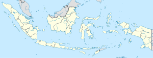
Distrito ang Kecamatan Baturiti sa Indonesya.[1] Nahimutang ni sa lalawigan sa Provinsi Bali, sa habagatan-kasadpang bahin sa nasod, 900 km sa sidlakan sa Jakarta ang ulohan sa nasod. Ang Kecamatan Baturiti nahimutang sa pulo sa Bali.[saysay 1]
Hapit nalukop sa lasang ang palibot sa Kecamatan Baturiti.[3] Dunay mga 319 ka tawo kada kilometro kwadrado sa palibot sa Kecamatan Baturiti nga hilabihan populasyon.[4] Ang klima tropikal nga kasalupan.[5] Ang kasarangang giiniton 21 °C. Ang kinainitan nga bulan Nobiyembre, sa 22 °C, ug ang kinabugnawan Agosto, sa 20 °C.[6] Ang kasarangang pag-ulan 2,148 milimetro matag tuig. Ang kinabasaan nga bulan Enero, sa 526 milimetro nga ulan, ug ang kinaugahan Agosto, sa 20 milimetro.[7]
- ↑ Cite error: Invalid
<ref>tag; no text was provided for refs namedgn7054921 - ↑ Cite error: Invalid
<ref>tag; no text was provided for refs namedvp - ↑ Cite error: Invalid
<ref>tag; no text was provided for refs namednasalandcover - ↑ Cite error: Invalid
<ref>tag; no text was provided for refs namednasapop - ↑ Cite error: Invalid
<ref>tag; no text was provided for refs namedkoppen - ↑ Cite error: Invalid
<ref>tag; no text was provided for refs namednasa - ↑ Cite error: Invalid
<ref>tag; no text was provided for refs namednasarain
Cite error: <ref> tags exist for a group named "saysay", but no corresponding <references group="saysay"/> tag was found
